Maps from RareNonFiction.com
New Arrivals
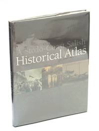
A Stó:lo-Coast Salish Historical Atlas
by Carlson, Keith T. (Editor); Xwelixweltel / The Honourable Judge Steven L. Point (Foreword); et al
- Condition
- Used - Very Good in Very Good dust jacket
- Edition
- First Edition
- Published
- 2001
- Binding
- Hardcover
- ISBN
- 9780295980447
- Quantity Available
- 1
- Seller
-
Ladysmith, British Columbia, CAN
- Item Price
-
$495.00
Show Details
Description:
Canada: Douglas & McIntyre Ltd. / Stó:lo Nation. Very Good in Very Good dust jacket. 2001. First Edition. Hardcover. 0295980443 . "Presents a comprehensive overview of Sto:lo-Coast Salish history. Full colour original maps, artwork and photographs grace the pages of this monumental volume, placing a vast wealth of easily accessible information at the fingertips of general… Read more about this item Item Price
$495.00
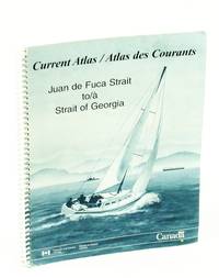
Current Atlas / Atlas Des Courants Juan De Fuca Strait to Strait of Georgia - Bilingual English/French
by Canadian Hydrographic Service
- Condition
- Used - Fair
- Edition
- Reprint
- Published
- 2010
- Binding
- Spiral Bound
- ISBN
- 9780660623009
- Quantity Available
- 1
- Seller
-
Ladysmith, British Columbia, CAN
- Item Price
-
$199.95
Show Details
Description:
Ottawa, Ontario: Canadian Hydrographic Service, Fisheries and Oceans Canada. Fair. 2010. Reprint. Spiral Bound. 0660623005 . "This current atlas covers the waters between Sooke and Campbell River, including the Gulf and San Juan Islands. Contains diagrams illustrating where to expect strong tidal streams or large eddies, as well as surface currents caused by the discharge of… Read more about this item Item Price
$199.95

Historical Atlas of Manitoba - A Selection of Facsimile Maps, Plans and Sketches from 1612 to 1969
by Warkentin, John; Ruggles, Richard I.
- Condition
- Used - Good
- Edition
- First Edition
- Published
- 1970
- Binding
- Hardcover
- Quantity Available
- 1
- Seller
-
Ladysmith, British Columbia, CAN
- Item Price
-
$250.00
Show Details
Description:
Winnipeg, Manitoba: The Historical and Scientific Society of Manitoba. Good. 1970. First Edition. Hardcover. "The intention of this atlas is simple. It is hoped that it will give readers an understanding of the historical and geographical development of the area which is Manitoba today through facsimile maps, selected to show the main events and cultural processes… Read more about this item Item Price
$250.00

The Canadian Oxford Atlas of the World
by The Cartographic Department of the Clarendon Press
- Condition
- Used - Good
- Edition
- Second Edition
- Published
- 1967
- Binding
- Hardcover
- Quantity Available
- 1
- Seller
-
Ladysmith, British Columbia, CAN
- Item Price
-
$149.95
Show Details
Description:
Toronto: Oxford University Press. Good. 1967. Second Edition. Hardcover. Reprint of the 1957 second edition. 93 pages. Large colour maps. Map endpapers. Unmarked with average wear to publisher's dark blue cloth decorated in gilt on front board. Gilt backstrip lettering mostly rubbed away. A sound vintage copy.; Folio . Item Price
$149.95

Atlas of Alberta Lakes
by Mitchell, Patricia; Prepas, Ellie (Editors)
- Condition
- Used - Very Good with no dust jacket
- Edition
- First Edition
- Published
- 1990
- Binding
- Hardcover
- ISBN
- 9780888642141
- Quantity Available
- 1
- Seller
-
Ladysmith, British Columbia, CAN
- Item Price
-
$495.00
Show Details
Description:
Edmonton, Alberta: The University of Alberta Press. Very Good with no dust jacket. 1990. First Edition. Hardcover. 0888642148 . "Brings together 100 of Alberta's most interesting, most popular or most studied lakes. Provides all the information lake users - anglers, cottage owners, vacationers, scientists and lake managers - might need. An extensive introduction explains the… Read more about this item Item Price
$495.00

The Fairbanks of Sheffield, 1688 to 1848
by Hall, T[homas] Walter
- Condition
- Used - Good
- Edition
- First Edition
- Published
- 1932
- Binding
- Paperback
- Quantity Available
- 1
- Seller
-
Ladysmith, British Columbia, CAN
- Item Price
-
$195.00
Show Details
Description:
Sheffield: J. W. Northend Limited. Good. 1932. First Edition. Paperback. "Reproductions of samples of the thousands of surveys made by members of the Fairbank family in their field-books. When considering The Fairbank Collection as a whole, it should be borne in mind that these seventy or more reproductions, from the Field-Book series, are a mere handful… Read more about this item Item Price
$195.00

The Atlas of Pern - A Complete Guide to Anne McCaffrey's Wonderful World of Dragons and Dragonriders
by Fonstad, Karen Wynn
- Condition
- Used - Good in Good dust jacket
- Edition
- Book Club Edition
- Published
- 1984
- Binding
- Hardcover
- ISBN
- 9781568652634
- Quantity Available
- 1
- Seller
-
Ladysmith, British Columbia, CAN
- Item Price
-
$250.00
Show Details
Description:
New York: Del Rey/Ballantine. Good in Good dust jacket. 1984. Book Club Edition. Hardcover. 1568652631 . 169 pages including index of place names, selected references and notes. "Provides a spellbinding tour of the world where the harassed settlers from Earth fight to overcome seemingly impossible odds and to carve out a new life for themselves and… Read more about this item Item Price
$250.00

The First Summer People: The Thousand Islands 1650-1910
by Smith, Susan Weston
- Condition
- Used - Very Good in Very Good dust jacket
- Edition
- First Edition
- Published
- 1993
- Binding
- Hardcover
- ISBN
- 9781550460377
- Quantity Available
- 1
- Seller
-
Ladysmith, British Columbia, CAN
- Item Price
-
$295.00
Show Details
Description:
Toronto: Stoddart / Boston Mills. Very Good in Very Good dust jacket. 1993. First Edition. Hardcover. 1550460374 . "The culmination of many years of research, [this work] contains interesting facts and legends collected from some 200 publications and countless hours of interviews. It also features dozens of previously unpublished maps and photographs. The second section… Read more about this item Item Price
$295.00

A Military History and Atlas of the Napoleonic Wars
by Esposito, Vincent J.; Elting, John Robert
- Condition
- Used - Very Good in Good dust jacket
- Edition
- Reprint
- Published
- 1980
- Binding
- Hardcover
- ISBN
- 9780853684343
- Quantity Available
- 1
- Seller
-
Ladysmith, British Columbia, CAN
- Item Price
-
$395.00
Show Details
Description:
USA: AMS Press, Inc.. Very Good in Good dust jacket. 1980. Reprint. Hardcover. 0853684340 . Over 300 pages. 1980 Reprint of the 1968 Praeger edition. Includes 169 full-page maps and supporting text plus a substantial list of recommended reading. Oblong 9.25" x 12.25". Book unmarked with light wear to publisher's illustrated red cloth. Binding tight. Average wear… Read more about this item Item Price
$395.00

Ottawa in Maps - A Brief Cartographical History of Ottawa (Canada) 1825-1973 / Ottawa Par Les Cartes - Breve Histoire Cartographique De La Ville D'Ottawa (Catalogue No. SA2-72/1974)
by Nagy, Thomas L.
- Condition
- Used - Good
- Edition
- First Edition
- Published
- 1974
- Binding
- Paperback
- Quantity Available
- 1
- Seller
-
Ladysmith, British Columbia, CAN
- Item Price
-
$250.00
Show Details
Description:
Ottawa, Canada: National Map Collection, Public Archives Canada, 1974. Book. Good. Paperback. First Edition. Folio - over 12" - 15" tall. [12], 87 pages. Bilingual English/French. Printed upon glossy stock. Illustrated throughout in blue and brown. "From its very beginning to the present time, the history of the nation's capital unfolds from the cartographical material housed… Read more about this item Item Price
$250.00

Stovel's Map of Alberta
by Stovel Company Limited
- Condition
- Used - Good
- Edition
- First Edition
- Published
- 1922
- Quantity Available
- 1
- Seller
-
Ladysmith, British Columbia, CAN
- Item Price
-
$395.00
Show Details
Description:
Winnipeg: Stovel Company Limited, Map Engravers and Publishers, 1922. Book. Illus. by Stovel Company Limited. Good. Map. First Edition. Double Elephant - over 25" - 50" tall. Wonderful 1922 colour map of Alberta "showing the complete railroad system in detail, and accurately locating all towns, post offices, railroad stations, etc. Provincial constituencies are outlined. Verso provides a detailed index… Read more about this item Item Price
$395.00

The Canadian Thresherman and Farmer Handy Atlas of The World
by Author Not Stated
- Condition
- Used - Fair
- Edition
- Revised Edition
- Published
- 1912
- Binding
- Hardcover
- Quantity Available
- 1
- Seller
-
Ladysmith, British Columbia, CAN
- Item Price
-
$250.00
Show Details
Description:
Winnipeg: E.H. Heath Company Ltd., 1912. Book. Fair. Hardcover. Revised Edition. 8vo - over 7¾" - 9¾" tall. 120 pages consisting of 89 pages of colour maps of the world, several colour diagramatic graphs, etc., and 25 pages of textual data including distances, historical items, cities and towns. The Canadian Thresherman and Farmer was published in Winnipeg from 1910… Read more about this item Item Price
$250.00

Mapas Turisticos Provinciales - Islas Canarias: Aprobados Por El Consejo Superior Geographico
by No Author
- Condition
- Used - Very Good
- Edition
- First Edition
- Published
- 1960
- Quantity Available
- 1
- Seller
-
Ladysmith, British Columbia, CAN
- Item Price
-
$129.95
Show Details
Description:
Madrid, Spain: Editorial Hernando, S.A., 1960. Book. Illus. by Mesonero, Ramon Vicente. Very Good. Map. First Edition. Elephant Folio - over 15" - 23" tall. Text in Spanish. One-sided color map of the Islas Canarias. 69 x 45cm. Clean and unmarked with moderate wear. Includes tourist information. A quality vintage copy.. Item Price
$129.95
![The Triangle Tour of British Columbia Canada - [Map] Supplement to the Canadian Rockies Folder](https://d3525k1ryd2155.cloudfront.net/h/081/983/1275983081.0.m.jpg)
The Triangle Tour of British Columbia Canada - [Map] Supplement to the Canadian Rockies Folder
by Canadian National Railways [CNR]
- Condition
- Used - Very Good
- Edition
- First Edition
- Published
- 1927
- Quantity Available
- 1
- Seller
-
Ladysmith, British Columbia, CAN
- Item Price
-
$350.00
Show Details
Description:
Canada: Canadian National Railways [CNR], 1927. Book. Very Good. Map. First Edition. Elephant Folio - over 15" - 23" tall. 62 x 43.5 cm one-sided colour pictorial map reduces to 22.5 x 10 cm when folded inside original blue card cover lettered in black. Illustrates the route of the CNR's Triangle Tour of British Columbia which included "Jasper National… Read more about this item Item Price
$350.00
![Arts of Asia Magazine, Volume 30, Number 1, January [Jan.] - February [Feb.] 2000 - The Island of Hong Kong](https://d3525k1ryd2155.cloudfront.net/h/104/968/1253968104.0.m.jpg)
Arts of Asia Magazine, Volume 30, Number 1, January [Jan.] - February [Feb.] 2000 - The Island of Hong Kong
by Gaeta, Gordian; Siu, Anthony K.K.; Tam, S.C.; Valdes, Cynthia Ongpin; Srivastava, K.M.; Anninos, Tony; De Guardiola, Jeanne; Fodor, Paula J.; Mehta, Yamina; Tan, Rita C.; Bernstein, Sam
- Condition
- Used - Very Good
- Edition
- First Edition
- Published
- 2000
- Binding
- Paperback
- Quantity Available
- 1
- Seller
-
Ladysmith, British Columbia, CAN
- Item Price
-
$99.95
Show Details
Description:
Hong Kong: Arts of Asia Publications Ltd., 2000. Book. Very Good. Single Issue Magazine. First Edition. 4to - over 9¾" - 12" tall. 148 pages. Printed upon glossy stock. Features: The Island of Hong Kong - political and economic origins of early western mapping; Is Hong Kong the old name of Ap Lei Chau Island?; The Secrets of… Read more about this item Item Price
$99.95
![The Library Atlas; Consisting of One Hundred and Ten [110] Maps Modern, Historical, and Classical Geography, &c.; With Descriptive Letterpress](https://d3525k1ryd2155.cloudfront.net/h/048/065/1243065048.0.m.jpg)
The Library Atlas; Consisting of One Hundred and Ten [110] Maps Modern, Historical, and Classical Geography, &c.; With Descriptive Letterpress
by Bryce, James; Collier, William F.; Schmitz, Leonhard
- Condition
- Used - Fair
- Edition
- First Edition
- Published
- 1876
- Binding
- Hardcover
- Quantity Available
- 1
- Seller
-
Ladysmith, British Columbia, CAN
- Item Price
-
$1,950.00
Show Details
Description:
Glasgow: William Collins, Sons, & Company, Limited, 1876. Book. Fair. Hardcover. First Edition. 4to - over 9¾" - 12" tall. 214, [110 maps], 142 [index] pages. "The continual extension of commerce into new channels, the rapid growth of the colonial possessions of the British Empire, the recent territorial changes in several kingdoms, both of Europe and Asia, and the… Read more about this item Item Price
$1,950.00

State of Arizona 1962 Road Map (plus Northwestern Mexico): Golden Anniversary of the Statehood of Arizona
by Arizona State Highway Commission / Rand McNally & Company
- Condition
- Used - Very Good
- Edition
- First Edition
- Published
- 1962
- Quantity Available
- 1
- Seller
-
Ladysmith, British Columbia, CAN
- Item Price
-
$79.95
Show Details
Description:
USA: Arizona State Highway Commission / Rand McNally & Company, 1962. Book. Very Good. Map. First Edition. Elephant Folio - over 15" - 23" tall. Color 9.75 x 4 inch road map (folds out to 36 x 19.5 inches). Includes index to cities and towns. Map on front. Tourist/state information on back. Clean, bright and unmarked… Read more about this item Item Price
$79.95

The Official Military Atlas of the Civil War (Original Title: Atlas to Accompany the Official Records of the Union and Confederate Armies
by Davis, Major George B.; Perry, Leslie J.; Kirkley, Jospeh W.
- Condition
- Used - Fine
- Jacket Condition
- Fine
- Edition
- Reprint
- Published
- 2003
- Binding
- Hardcover
- ISBN
- 9780760750445
- Quantity Available
- 1
- Seller
-
Ladysmith, British Columbia, CAN
- Item Price
-
$249.95
Show Details
Description:
USA: Barnes & Noble Books, 2003. Book. Fine. Hardcover. Reprint. Elephant Folio - over 15" - 23" tall. 397 pages. "After the Civil War, the U.S. Government and the Army embarked on a landmark endeavor, compiling a military history of all the official military documents from both sides of the war, entitled War of the Rebellion: A Compilation of… Read more about this item Item Price
$249.95
![[WWI] War Map Issued By The Family Herald & Weekly Star](https://d3525k1ryd2155.cloudfront.net/h/198/656/1193656198.0.m.jpg)
[WWI] War Map Issued By The Family Herald & Weekly Star
by G.W. Bacon & Co. Ltd.
- Condition
- Used - Good
- Edition
- First Edition
- Published
- 1918
- Quantity Available
- 1
- Seller
-
Ladysmith, British Columbia, CAN
- Item Price
-
$295.00
Show Details
Description:
Montreal, Canada: The Family Herald and Weekly Star, 1918. Book. Good. Map. First Edition. Double Elephant - over 25" - 50" tall. This copy bearing the ink stamp of F.R. Swanton of Davis Point, Manitoba. Frederick Swanton served in the 200th (Winnipeg) Battalion, Canadian Expeditionary Force (CEF) during WWI. Illustrated red card covers measure 8.25" x 5.5". … Read more about this item Item Price
$295.00

British Columbia (B.C.) Ferries - 1968 Route Map
by British Columbia (B.C.) Ferries
- Condition
- Used - Very Good
- Edition
- First Edition
- Published
- 1968
- Quantity Available
- 1
- Seller
-
Ladysmith, British Columbia, CAN
- Item Price
-
$79.95
Show Details
Description:
British Columbia: B.C. Ferries, 1968. Book. Very Good. Map. First Edition. 8vo - over 7¾" - 9¾" tall. 9" x 4" - folds out to 24" x 18". Colour map on one side shows B.C. Ferry routes. Reverse side provides details of tourist destinations with colour photos, reservation details for the sailing to Prince Rupert, corporate contact… Read more about this item Item Price
$79.95