Rare and Antiquarian Books
Rare books from Roz Hulse
Results 1 - 15 of 67

Asia from the Best Authorities, Russell, ca.1800
by Russell
- Used
- Condition
- Used
- Seller
-
Plymouth, Devon
- Item Price
-
$25.43$35.00 shipping to USA
Show Details
Item Price
$25.43
$35.00
shipping to USA

Channel Islands, Tallis, ca.1851
by John Tallis & Rapkin
- Used
- Condition
- Used
- Seller
-
Plymouth, Devon
- Item Price
-
$52.13$35.00 shipping to USA
Show Details
Item Price
$52.13
$35.00
shipping to USA

North America from the Best Authorities, Russell, ca.1800
by Russell
- Used
- Condition
- Used
- Seller
-
Plymouth, Devon
- Item Price
-
$25.43$35.00 shipping to USA
Show Details
Item Price
$25.43
$35.00
shipping to USA
![The Countye Palatine of Chester with that most Ancient Citie described. [Cheshire], John Speed,...](https://d3525k1ryd2155.cloudfront.net/h/266/067/50067266.0.m.jpg)
More Photos
The Countye Palatine of Chester with that most Ancient Citie described. [Cheshire], John Speed, [1676]
by John Speed
- Used
- very good
- Condition
- Used - Very Good
- Edition
- Basset & Chiswell, [London, 1610-1676].
- Seller
-
Plymouth, Devon
- Item Price
-
$953.55$35.00 shipping to USA
Show Details
Item Price
$953.55
$35.00
shipping to USA

Paper and Scissors in the Schoolroom by Emily Weaver. 1893
by Emily Weaver
- Used
- Hardcover
- Condition
- Used
- Binding
- Hardcover
- Seller
-
Plymouth, Devon
- Item Price
-
$38.14$35.00 shipping to USA
Show Details
Item Price
$38.14
$35.00
shipping to USA

Philips Special Map of the Nile, The Advance on Khartum and the Environs of Omdurman. Cc1900
by George Philips and Son,
- Used
- Condition
- Used
- Seller
-
Plymouth, Devon
- Item Price
-
$33.06$35.00 shipping to USA
Show Details
Item Price
$33.06
$35.00
shipping to USA

Sea Chart of Milford Haven,
by Greenville Collins
- Used
- very good
- Condition
- Used - Very Good
- Edition
- Original 18th Century, Hand Coloured Sea Chart
- Seller
-
Plymouth, Devon
- Item Price
-
$127.14$35.00 shipping to USA
Show Details
Item Price
$127.14
$35.00
shipping to USA

Sea Chart Portland to the Lizard. De Custe van Engelant tußchen Poortlant en Lezard [Sea Chart Portland to the Lizard]. Jacob Aertsz Colomb. Ca1640: Sea Chart Portland to the Lizard.
by Jacob Aertsz Colomb
- Used
- Condition
- Used
- Seller
-
Plymouth, Devon
- Item Price
-
$228.85$35.00 shipping to USA
Show Details
Item Price
$228.85
$35.00
shipping to USA

Original Antique Map of Cheshire
by John Cary
- Used
- good
- Condition
- Used - Good
- Seller
-
Plymouth, Devon
- Item Price
-
$50.86$35.00 shipping to USA
Show Details
Item Price
$50.86
$35.00
shipping to USA

More Photos
Arasmanes or The Seeker.
by E Bulwer Lytton
- Used
- good
- Condition
- Used - Good
- Edition
- 1st Edition
- Seller
-
Plymouth, Devon
- Item Price
-
$57.21$35.00 shipping to USA
Show Details
Item Price
$57.21
$35.00
shipping to USA

St Peters Church. Isle of Thanet.: Engraved Original Antique Print. Uncoloured.
by B T Pouncy
- Used
- good
- Condition
- Used - Good
- Seller
-
Plymouth, Devon
- Item Price
-
$89.00$35.00 shipping to USA
Show Details
Item Price
$89.00
$35.00
shipping to USA

More Photos
A Theoretical and Practical Treatise on Subterraneous Surveying, and the Magneticariation of the Needle.: A rare early work on mine surveying.
by Thomas Fenwick
- Used
- Hardcover
- first
- Condition
- Used
- Edition
- 1st Edition
- Binding
- Hardcover
- Seller
-
Plymouth, Devon
- Item Price
-
$241.57$35.00 shipping to USA
Show Details
Item Price
$241.57
$35.00
shipping to USA
More Photos
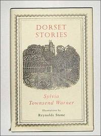
Dorset Stories.
by Sylvia Townsend Warner
- Used
- Hardcover
- first
- Condition
- Used
- Edition
- 1st Edition.
- Binding
- Hardcover
- Seller
-
Plymouth, Devon
- Item Price
-
$50.86$35.00 shipping to USA
Show Details
Item Price
$50.86
$35.00
shipping to USA
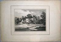
Valle Crucis Abbey.: Original uncoloured lithograph
by Miss Smirke, Eng J Harriden
- Used
- good
- Condition
- Used - Good
- Edition
- 1st Edition
- Seller
-
Plymouth, Devon
- Item Price
-
$38.14$35.00 shipping to USA
Show Details
Item Price
$38.14
$35.00
shipping to USA
![Japan and Corea [Korea].](https://d3525k1ryd2155.cloudfront.net/h/490/669/882669490.0.m.jpg)
Japan and Corea [Korea].: Original Antue Map.
by John Tallis & Rapkin
- Used
- good
- Condition
- Used - Good
- Edition
- 1st
- Seller
-
Plymouth, Devon
- Item Price
-
$127.14$35.00 shipping to USA
Show Details
Item Price
$127.14
$35.00
shipping to USA
