Add to Want List
Rare and Antiquarian Books

Maps and Atlases

Results 256 - 270 of 300
CENT VUES SUISSES remarquables par leur Situation, ou par des Faits Historiques. Dessinnées et...

CENT VUES SUISSES remarquables par leur Situation, ou par des Faits Historiques. Dessinnées et gravées par Hess, Hegui [sic], König, Lory, Meyer, Wetzel etc.

by Orell, Füssli (Publishers)

  • Used
  • very good
  • Hardcover
Condition
Used - Very Good
Binding
Hardcover
Seller
Blockley, Gloucestershire
Seller rating:
This seller has earned a 5 of 5 Stars rating from Biblio customers.
Item Price
$968.81
$25.75 shipping to USA

Show Details

Description:
Zurich: Orell, Füssli et Comp., 1825 approx). Hardcover. Very Good. Copperplate engravings (100) of Swiss views and domestic scenes by Hess, Hegui, König, Lory, Meyer, Wetzel and others.. Oblong octavo green morocco elaborately gilt on 4 raised bands (lacks lowest spine compartment, tips & hinges worn but sound) All Edges Gilt. Titlepage +[3]pp publisher's list +[4]pp contents + 100 plate leaves printed one side only. Clean and crisp - lovely views with a few genre scenes - wedding, peasants defending land against invaders in 1798, making cheese etc. Minor foxing almost entirely to the margins or blank back of plates, small wormhole at foot of 3 leaves. *A charming work containing views by various artists here collected together for the first time (Lonchamp 3199).
Item Price
$968.81
$25.75 shipping to USA
Nouvel atlas portatif de la géographie ancienne, pour servir à l'intelligence des auteurs...
More Photos

Nouvel atlas portatif de la géographie ancienne, pour servir à l'intelligence des auteurs anciens, et guider dans la lecture de l'histoire

by DELAMARCHE, Felix

  • Used
  • near fine
  • Hardcover
Condition
Used - Near Fine
Binding
Hardcover
Seller
COLUMBIA, Missouri
Seller rating:
This seller has earned a 5 of 5 Stars rating from Biblio customers.
Item Price
$750.00
FREE shipping to USA

Show Details

Description:
1790 Delamarche ATLAS MAPS Ancient Geography Asia Africa Turkey Macedonia Syria

Felix Delamarche was a well-known and important French cartographer from the 18th-century. His best and most widely used atlas was 'Atlas of Ancient and Modern Geography;' a work that was used by the Saint Cyr French military school. This 1790 edition of Delamarche's atlas includes 17 double-page maps with color country borders that include:

World Map (Western & Eastern Hemispheres)
Europe
British Isles
Spain
Gaul
Germany
Germano-Sarmatia
Italy
Dacia et MĹ“sia, Thracia, Macedonia
Greece
Asia
Asia Minor
Colchis, Iberia, Albania
Assyria, Mesopotamia, Babylonia, Susiana pars Persidis, Syria, Phœnice, Palestina, Arabia Petræa
Africa
Africa Numida Mauretania
Egypt

Item number: #8288
Price: $750
DELAMARCHE, Felix

Nouvel atlas portatif de la géographie ancienne, pour servir à l'intelligence des auteurs anciens, et guider dans la lecture de l'histoire
Paris : chez l'auteur, 1790.

Details:… Read More
Item Price
$750.00
FREE shipping to USA
Specimens and parts; containing a history of the county of Kent: and a dissertation on the laws,...
More Photos

Specimens and parts; containing a history of the county of Kent: and a dissertation on the laws, from the reign of Edward the Confessour, to Edward the First; of a topographical, commercial, civil, and nautical history of South Britain ... By Samuel Henshall ...

by HENSHALL, Samuel

  • Used
  • near fine
  • Hardcover
  • first
Condition
Used - Near Fine
Edition
First
Binding
Hardcover
Seller
COLUMBIA, Missouri
Seller rating:
This seller has earned a 5 of 5 Stars rating from Biblio customers.
Item Price
$499.00
FREE shipping to USA

Show Details

Description:
1798 1st ed Samuel Henshall KENT County MAP England Specimens & Parts Britain

Samuel Henshall was an 18th-century English philologist who is best remembered for his historical perspective of the county of Kent. First published in 1798, 'Specimens and Parts' is a thorough summary of all aspects of Kent – geography, population, historical implications throughout Southern Britain...

This impressive 1798 first edition is complete with an impressive folding map Kent County in England.

Item number: #8628
Price: $499
HENSHALL, Samuel
Specimens and parts; containing a history of the county of Kent: and a dissertation on the laws, from the reign of Edward the Confessour, to Edward the First; of a topographical, commercial, civil, and nautical history of South Britain ... By Samuel Henshall ...
London: Printed for the author; R. Faulder; and F. and C. Rivington, 1798. First edition.

Details:
·
Collation: Complete with all pages
o
xxx (i.e. xxxiv), 104, 41, [1]
o
Impressive, folding map of… Read More
Item Price
$499.00
FREE shipping to USA
New England : a handbook for travelers
More Photos

New England : a handbook for travelers

by Osgood

  • Used
  • near fine
  • Hardcover
  • first
Condition
Used - Near Fine
Edition
First
Binding
Hardcover
Seller
COLUMBIA, Missouri
Seller rating:
This seller has earned a 5 of 5 Stars rating from Biblio customers.
Item Price
$499.00
FREE shipping to USA

Show Details

Description:
1873 1ed Osgood New England ATLAS Traveler Guide MAPS New York Quebec Geography

James Osgood's travelers handbook was one of the most popular and oft-used 19th-century atlases of New England. This book includes descriptions of mountain ranges and tips on traveling through Quebec and New York.
This rare first edition includes the often omitted huge, folding map by H.F. Walling.
Item number: #10275
Price: $499

Osgood

New England : a handbook for travelers
Boston : James R. Osgood Co., 1873. First edition.

Details:

·
Collation: Complete with all pages
o [xvi], 400, [26]
o
Folding maps throughout, large folding map in back board pocket
·
Language: English
·
Binding: Cloth; tight and secure
·
Size: ~ 6.5in X 4.5in (16.5cm x 11cm)
Our Guarantee:
Very Fast. Very Safe. Free Shipping Worldwide.
Customer satisfaction is our priority! Notify us with 7 days of receiving, and we will offer a full refund without reservation!

10275Photos available upon request.
Item Price
$499.00
FREE shipping to USA
An atlas of antient geography
More Photos

An atlas of antient geography

by BUTLER, Samuel

  • Used
  • near fine
  • Hardcover
Condition
Used - Near Fine
Binding
Hardcover
Seller
COLUMBIA, Missouri
Seller rating:
This seller has earned a 5 of 5 Stars rating from Biblio customers.
Item Price
$499.00
FREE shipping to USA

Show Details

Description:
1857 ATLAS Hand-colored MAPS Ancient Geography Greece Holy Land France Britain

An impressive 1857 atlas with double-page hand-colored maps!

Edited and published by Samuel Butler, this atlas includes maps of various countries of the ancient world – Great Britain, Spain, France, Greece and Greek Islands, Holy Land and Israel, and many more. Butler was 19th-century Bishop and historian, not to be confused with the 17th-century poet, author of 'Hudibras', or the late 19th-century author of Utopian novel 'Erewhon'.

Item number: #10709
Price: $499
BUTLER, Samuel
An atlas of antient geography
Philadelphia, Carey, Lea, & Blanchard, 1857.

Details:

·
Collation: Complete with all pages
o
21 double-page colored maps
·
Language: English
·
Binding: leather; tight and secure
·
Size: ~9in X 6in (23cm x 15cm)
Our Guarantee:
Very Fast. Very Safe. Free Shipping Worldwide.
Customer satisfaction is our priority! Notify us with 7 days of receiving, and we will offer a full refund… Read More
Item Price
$499.00
FREE shipping to USA
Atlas of New York and vicinity : from actual surveys
More Photos

Atlas of New York and vicinity : from actual surveys

by BEERS, F.W.

  • Used
  • near fine
  • Hardcover
Condition
Used - Near Fine
Binding
Hardcover
Seller
COLUMBIA, Missouri
Seller rating:
This seller has earned a 5 of 5 Stars rating from Biblio customers.
Item Price
$950.00
FREE shipping to USA

Show Details

Description:
1867 HUGE ATLAS New York City Brooklyn Yonkers Color City MAPS FW Beers
A rare 19th-century atlas of New York! Collected by F.W. Beers, this enormous atlas contains numerous maps contains views of New York City, cities and towns, Burroughs, and neighborhoods, as well as illustrations of iconic locations and buildings. Notable maps included in this atlas include:
·
Peekskill
·
Beekmantown, Tarrytown, Irving
·
Putnam Valley and Philipstown
·
Cortland
·
Singsing
·
Yonkers
·
New York City
·
Brooklyn
Item number: #18366
Price: $950
BEERS, F.W.
Atlas of New York and vicinity : from actual surveys
New York : F.W. Beers, A.D. Ellis, and G.G. Soule, 1867.

Details:

·
Collation: Complete with all pages
o 35 maps
·
Provenance: Handwritten – John Bailey
·
Language: English
·
Binding: Leather; secure
·
Size: ~17.75in X 14.75in (45cm x 37.5cm)
Our Guarantee:
Very Fast. Very Safe. Free Shipping Worldwide.… Read More
Item Price
$950.00
FREE shipping to USA
A star atlas for the library, the school, and the observatory showing 6,000 stars and 1,500...
More Photos

A star atlas for the library, the school, and the observatory showing 6,000 stars and 1,500 objects of interest

by PROCTOR, Richard A

  • Used
  • near fine
  • Hardcover
Condition
Used - Near Fine
Binding
Hardcover
Seller
COLUMBIA, Missouri
Seller rating:
This seller has earned a 5 of 5 Stars rating from Biblio customers.
Item Price
$599.00
FREE shipping to USA
Show Details

Description:
1874 Astronomy Star ATLAS Zodiac Constellation MAPS Richard Proctor Astrology
Richard Proctor was a 19th-century English astronomer known for his studies on the planets in the solar system as well as the moon and the sun. In his many astronomical books, Proctor discusses his research on the planets, stars and constellations, and the sun, as well as his observations on meteors and comets. His most fascinating work was 'A Star Atlas' – an impressive collection of star and constellation charts and night sky maps.

Item number: #19450
Price: $599
PROCTOR, Richard A
A star atlas for the library, the school, and the observatory showing 6,000 stars and 1,500 objects of interest
London : Longmans, Green, 1874.

Details:

· Collation: Complete with all pages
o
14, [2]
o
14 double-page charts
· Language: English
· Binding: Hardcover; tight and secure
o
Cloth
· Size: ~14.75in X 9.75in (37.5cm x 25cm)
· Quite scarce
Our Guarantee:
Very Fast. Very Safe. Free Shipping… Read More
Item Price
$599.00
FREE shipping to USA
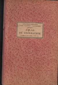
ATLAS DE GÉOGRAPHIE
More Photos

ATLAS DE GÉOGRAPHIE

by GAULTIER, L'Abbé (Aloisius Edouard Camille) (1746-1818)

  • Used
  • Hardcover
Condition
Used - Bom / Good / Bon
Binding
Hardcover
Seller
Cascais, Portugal
Seller rating:
This seller has earned a 5 of 5 Stars rating from Biblio customers.
Item Price
$272.00
$17.00 shipping to USA

Show Details

Description:
Paris: Librairie Classique et D'Éducation. Editorial / Hard Cover. Bom / Good / Bon. In-fólio (435x286). 1 Vol. de 21 fls. Contém 15 cartas coloridas de dupla página em muito bom estado e com cartonagem editorial.
Item Price
$272.00
$17.00 shipping to USA
Atlas national illustré des 86 départements et des possessions de la France divisé par...
More Photos

Atlas national illustré des 86 départements et des possessions de la France divisé par arrondissements, cantons et communes

by LEVASSEUR, Victor

  • Used
  • near fine
  • Hardcover
  • first
Condition
Used - Near Fine
Edition
First
Binding
Hardcover
Seller
COLUMBIA, Missouri
Seller rating:
This seller has earned a 5 of 5 Stars rating from Biblio customers.
Item Price
$795.00
FREE shipping to USA

Show Details

Description:
1846 1ed HUGE French ATLAS 43 MAPS Illustrated Victor Lefasseur ENORMOUS France
An absolutely enormous French atlas by Victor Levasseur!
This huge, oblong atlas contains 43 fully-illustrated maps of various regions, cities, and counties from around France each decorated with exquisite decorated borders.

Item number: #20847
Price: $795
LEVASSEUR, Victor
Atlas national illustré des 86 départements et des possessions de la France divisé par arrondissements, cantons et communes
Paris: publié par A. Combette Editeur, 1846.

Details:

· Collation: Complete with all pages;
o
43 plates of maps, plus engraved title page
· Provenance: Binding stamp – Mlle. Pauline Charuel
· Language: French

· Binding: Leather; tight and secure
· Size: ~15.25in X 22in (39cm x 56cm)
Our Guarantee:
Very Fast. Very Safe. Free Shipping Worldwide.
Customer satisfaction is our priority! Notify us with 7 days of receiving, and we will offer a full refund without reservation!

20847Photos… Read More
Item Price
$795.00
FREE shipping to USA
Mitchell’s New School Atlas: Mitchell’s Modern Atlas
More Photos

Mitchell’s New School Atlas: Mitchell’s Modern Atlas

by MITCHELL, S Augustus

  • Used
  • near fine
  • Hardcover
Condition
Used - Near Fine
Binding
Hardcover
Seller
COLUMBIA, Missouri
Seller rating:
This seller has earned a 5 of 5 Stars rating from Biblio customers.
Item Price
$599.00
FREE shipping to USA

Show Details

Description:
1886 Mitchell School ATLAS 44 MAPS America Holy Land Europe New Zealand India

The name Mitchell has long been synonymous with 19th-century maps; in fact, Mitchell maps are often considered the best of atlas maps from the 1800s. S Augustus Mitchell published an important geography book designed for schools and with it an impressive atlas. This 1886 'modern' atlas contains a series of 44 copper maps including maps not commonly found in other atlases of this era such as New Zealand, Bolivia, Hayti, Liberia. Of course, the most popular maps are still the maps of Europe, North America, Great Britain, and even California – all of which are included in this fine atlas.

Item number: #21730
Price: $599

MITCHELL, S Augustus

Mitchell's New School Atlas: Mitchell's Modern Atlas

Philadelphia: published by E.H. Butler & Co., 1886.

Details:
• Collation: Complete with all pages
o [2], 24
o 44 numbered maps, hand colored
• Language: English
• Binding: Hardcover; tight and secure
• Size: ~12.25in X… Read More
Item Price
$599.00
FREE shipping to USA
La Géographie Françoise contenant les Descriptions, les Cartes, et le Blason des Provinces de...
More Photos

La Géographie Françoise contenant les Descriptions, les Cartes, et le Blason des Provinces de France.

by DU VAL, Pierre

  • Used
  • Hardcover
Condition
Used
Binding
Hardcover
Seller
Richelieu, France
Seller rating:
This seller has earned a 5 of 5 Stars rating from Biblio customers.
Item Price
$1,080.69
$29.00 shipping to USA

Show Details

Description:
Paris: Chez l'auteur, 1677. Scarce. Original full leather binding. Gilt decorations and title to spine. Marbled endpapers. Beautifully illustrated with a double-page engraved title and hand numbered double page table of contents. Contains 34 double-page engraved maps, mounted on tabs. Uncoloured. Boards are a little rubbed at edges, contents in very good condition. 165 x 110 mm (6½ x 4¼ inches). . Rare. Reliure d'origine plein cuir. Décors dorés et titre au dos. Gardes marbrées. Magnifiquement illustré avec un titre gravé en double page et une table des matières en double page numérotée à la main. Contient 34 cartes gravées en double page, montées sur onglets. Incolore. Plats un peu frottés sur les bords, contenu en très bon état. 165 × 110 mm.
Item Price
$1,080.69
$29.00 shipping to USA
A PLAN OF THE CITY OF  BABYLON ACCORDING TO  HERODOTUS AND  F. KIRCHER

A PLAN OF THE CITY OF BABYLON ACCORDING TO HERODOTUS AND F. KIRCHER

by BABYLON - Original Antique etching

  • Used
  • Fine
Condition
Used - Fine
Seller
Tel-Aviv, Israel
Seller rating:
This seller has earned a 2 of 5 Stars rating from Biblio customers.
Item Price
$250.00
$25.00 shipping to USA

Show Details

Description:
1732. No Binding. Fine. ORIGINAL ANTIQUE ETCHING (copper plate) DATED 1732, depicting the ancient city of Babylon with the TOWER OF BABEL and THE HANGING GARDENS ( THE HANGING GARDENS ARE ONE OF THE SEVEN WONDERS OF THE ANCIENT WORLD ) - Size of image in cm 42 x 30 cm plus margins with title .. Original centerfold. Crisp paper. FINE CONDITION.
Item Price
$250.00
$25.00 shipping to USA
Les acquisitions de la France en Lorraine, Munster 1648, des Pyrenees 1659.
More Photos

Les acquisitions de la France en Lorraine, Munster 1648, des Pyrenees 1659.

by DUVAL, Pierre [cartog.]

  • Used
  • near fine
  • Hardcover
  • first
Condition
Used - Near Fine
Edition
First
Binding
Hardcover
Seller
COLUMBIA, Missouri
Seller rating:
This seller has earned a 5 of 5 Stars rating from Biblio customers.
Item Price
$1,500.00
FREE shipping to USA

Show Details

Description:
1660 ATLAS 1ed 44 MAPS of Lorraine France Nancy Treaty of Munster & Pyrenees

A rare 17th-century edition collection of engravings of French city views from environs based on the towns involved in the Treaty of Munster of 1648 and the Treaty of Pyrenees of 1659. This work contains views and maps of the following cities:
· Stenay
· Dun, Ariege
· Clermont
· Bar
· Ligny
· St Mihel
· Marsal
· Moyenvic
· Metz
· Toul / Nancy
· Verdun

Item number: #23153
Price: $1500

DUVAL, Pierre [cartog.]

Les acquisitions de la France en Lorraine, Munster 1648, des Pyrenees 1659.

[Paris: 1660]. 1st edition

Details:
· Collation: Complete with all pages
o 44 hand-numbered plates
· Provenance:
o Armorial bookplate – David Bosanquet, 1739
o Handwritten – Geog. Gerxe
o Handwritten – Richard Bosanquet
· Language: French
· Binding: Leather; tight and secure
· Size: ~6.5in X 8.75in… Read More
Item Price
$1,500.00
FREE shipping to USA
Monteith's Comprehensive Geography, 1882
More Photos

Monteith's Comprehensive Geography, 1882: With Expanded Kentucky Section

by Monteith, James

  • Used
  • good
  • Hardcover
Condition
Used - Good
Edition
1882
Binding
Hardcover
Seller
Lincoln, Nebraska
Seller rating:
This seller has earned a 5 of 5 Stars rating from Biblio customers.
Item Price
$137.75$123.98
Save $13.77!
$5.00 shipping to USA

Show Details

Description:
Monteith's Independent Course, Comprehensive Geography, 1882, 116 pages main section, plus expanded section on Kentucky of 7 pages. Fully illustrated with color maps. New York: A S Barnes.
Condition: Not a Library Book. This book was professionally restored. Interior is clean, with no stamps, crimps, etc. within. New firm binding with gilt lettered label as shown. Please review all photos and ask for more if needed for a sound buying decision. Some archival tape was used within, not affecting readability.
*Please Note: This item will be shipped to your address of record AND will require a verified signature upon receipt. Thank you for tracking your purchase and being available to sign for it upon delivery. We appreciate your business and hope to do business with you again!*
**Attention International Buyers** For all standard international book orders, we will be using Asendia consolidated shipping or the DHL international shipping program through Biblio.com. If you should choose expedited shipping… Read More
Item Price
$137.75$123.98
Save $13.77 !
$5.00 shipping to USA
Papillon
More Photos

Papillon

by Charriere, Henri

  • Used
  • very good
  • Hardcover
  • first
Condition
Used - Very Good
Edition
First US Edition
Binding
Hardcover
Seller
Salem, Oregon
Seller rating:
This seller has earned a 5 of 5 Stars rating from Biblio customers.
Item Price
$300.00$150.00
Save $150.00!
$5.00 shipping to USA

Show Details

Description:
Henri Charriere. Papillon. 1970 William Morrow First U.S. Edition. USED. VG/G Unclipped $8.95 Dust jacket. "An international sensation – the #1 bestseller in France, England, Germany, Italy, Spain and other countries" 434 pages 6 ½ X 9 3/8. Former owner signature on title page.
Item Price
$300.00$150.00
Save $150.00 !
$5.00 shipping to USA